BIA, PPL & ATPL revision
Preparing a VFR Navigation: Nav Log, Frequencies and Flight Plan in One Tool
By ForAllPilots · Published · 3 min read
Reviewed and approved by the site's editor before publication. Our method (FR)
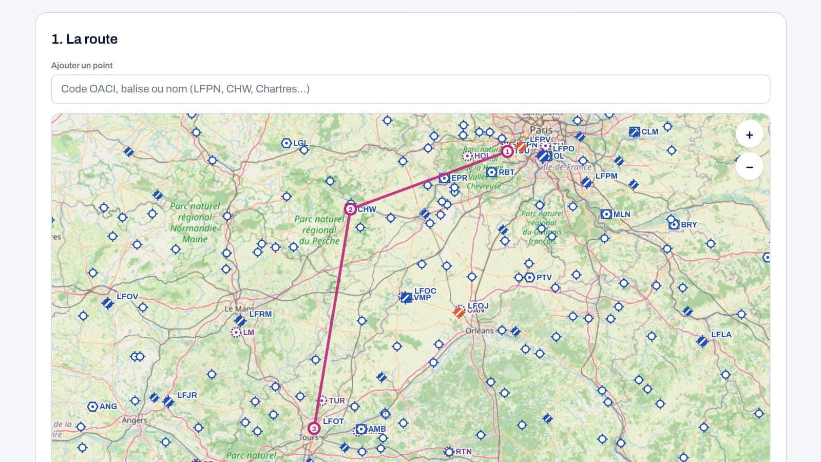
Preparing a navigation is the moment when PPL theory becomes concrete: true track, magnetic variation, the triangle of velocities, fuel, airspace, frequencies, flight plan. ForAllPilots now offers a free VFR flight planner that handles all of this from a route drawn on the map, on the website (Pilot Corner, “Preparation” tab, or the “Flight Preparation” page) and in the iPhone app. Here’s what it calculates, where its data comes from, and how to use it to train.
Plotting the Route and Choosing Your Aircraft
The route is built on the map or by code: French aerodromes (by their ICAO identifier or name), VOR, VOR-DME and NDB beacons, or free turning points placed wherever you like. Each point can be moved or removed in one gesture, and the preparation stays saved in your browser.
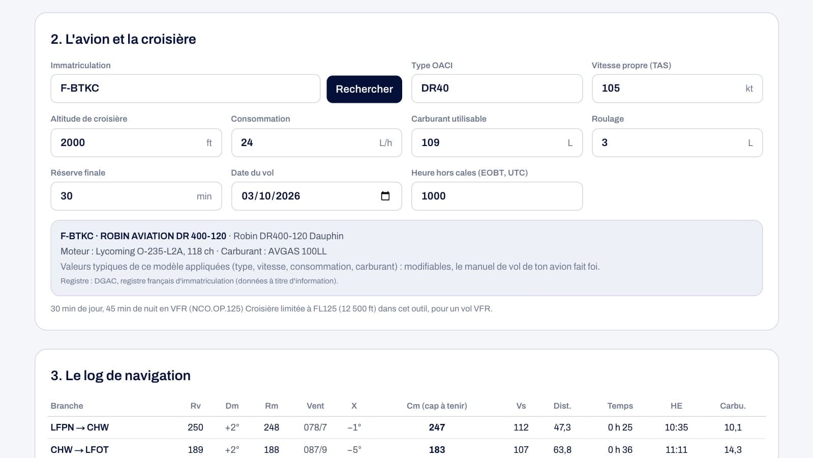
The aircraft is found by its registration in the public registers of the DGAC (France), the FAA (United States) and the Norwegian authority: manufacturer, model and, for a US-registered aircraft, the engine. For common light aircraft (DR400, Cessna 172, PA-28, TB, Diamond, Cirrus...), the planner suggests a typical cruise speed, fuel consumption and usable fuel, which you then correct using your aircraft flight manual. Cruise is capped at FL125 in the tool.
A Nav Log Calculated with Forecast Wind
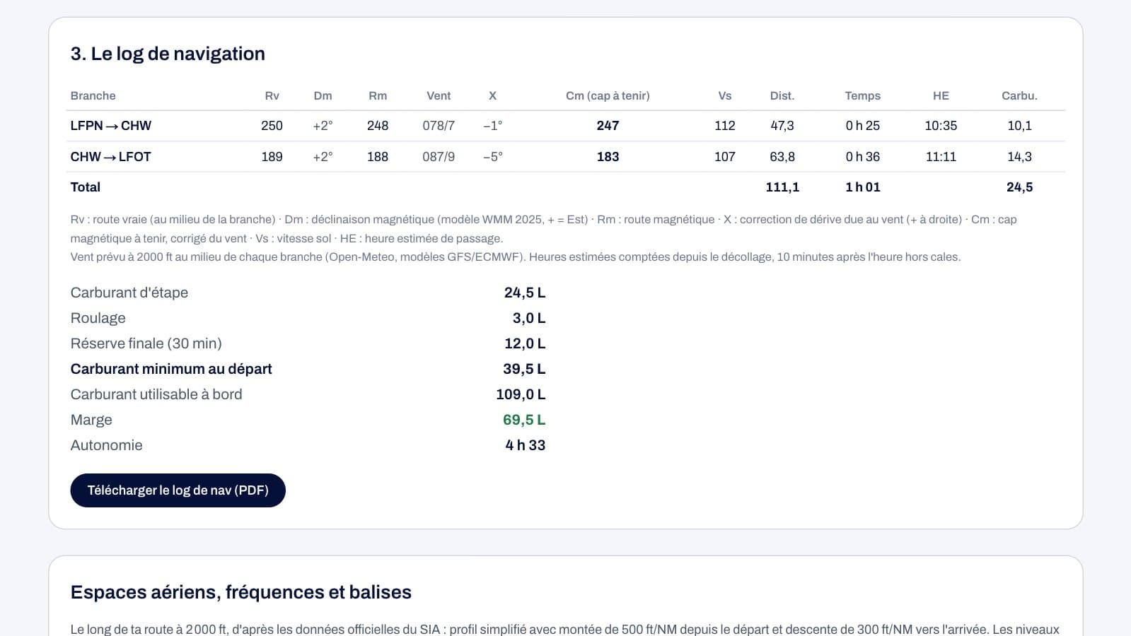
For each leg, the log gives the distance, the true track at the midpoint of the leg, the magnetic variation on the date of the flight (NOAA’s World Magnetic Model 2025), the magnetic track, and then the forecast wind at your altitude at the midpoint of the leg (GFS and ECMWF models via Open-Meteo). The triangle of velocities derives the drift correction, the magnetic heading to fly, the ground speed, the time, and the estimated time of passage.
The fuel calculation follows regulatory logic: trip fuel, taxi fuel, final reserve (30 minutes by day, 45 minutes by night under VFR), minimum fuel at departure, margin and endurance. An excessive headwind or insufficient fuel is flagged. This is a good opportunity to redo the calculation by hand and compare: it’s exactly what navigation exams require.
Airspace and the Frequency to Contact, Leg by Leg
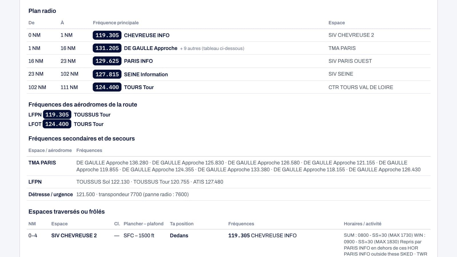
Based on official SIA data (AIP France, updated with every 28-day AIRAC cycle), the planner follows your route with a realistic profile: climb from departure, cruise, descent into the arrival. It lists every CTR, TMA, CTA, SIV, RMZ, TMZ and every P, R or D zone crossed or skirted, with its class, floor, ceiling and operating hours, and tells you whether you’re inside it, just below, or just above.
The radio plan shows the main frequency to contact every thousand feet: the tower within a CTR, approach within a TMA — taking published sectors into account (for example, Montpellier’s approach sectors) — and SIV flight information elsewhere. Secondary and emergency frequencies (other sector frequencies, ground, ATIS, 121.500) are grouped in a separate table, along with the frequencies for the departure and arrival aerodromes.
The planner warns you if your altitude would take you into Class A airspace, airspace prohibited to VFR, or a prohibited zone, and reminds you to check the activity of restricted and danger areas (NOTAM, SUP AIP, AZBA). It also lists the VOR and NDB beacons along your route and nearby parachute drop zones.
The ICAO Flight Plan, Box by Box, and a PDF for the Kneeboard
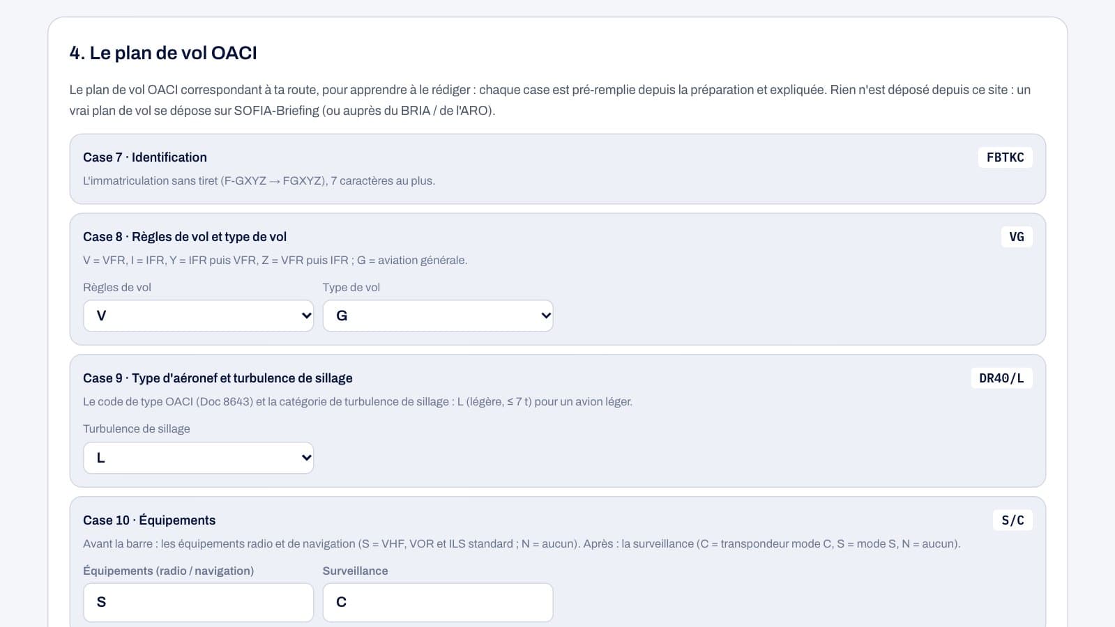
The flight plan is filled in from your preparation: identification, flight rules and type of flight, aircraft type and wake turbulence category, equipment, departure and time, speed, level and route, destination, duration and alternates, other information, endurance. Each box is explained so you learn how to fill it in, and the complete FPL message can be copied in one click. Nothing is filed from ForAllPilots: an actual flight plan must be filed via SOFIA-Briefing.
The nav log can be downloaded as an A4 landscape PDF, with an ATA column to fill in during the flight, the fuel calculation, the radio plan, secondary frequencies, the airspace crossed, the beacons and the FPL message. It’s marked as a training document, not an official log.
A Training Tool, Not an Operational One
The planner is designed for learning and revision: understanding why heading differs from track, seeing the effect of wind on ground speed and fuel, knowing which unit to call and when. Before an actual flight, everything must be checked against official sources: VAC chart, 1:500,000 chart, AIP, NOTAM and weather briefing.
To go further on the theory, ForAllPilots’ PPL and ATPL question banks cover navigation, meteorology and regulations, and the Pilot Corner brings together the other free tools: weather, unit converter, navigation calculator and FTL.